New York City
Can New York City's flood protection developments weather a storm?
Some of New York City’s biggest new flood protection and resiliency project developments on the water may still be fairly vulnerable to flooding.
The Battery Park Underpass, two days after Hurricane Sandy in 2012. Ovidiu Hrubaru/Shutterstock


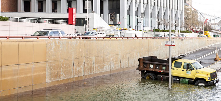
The damage that Superstorm Sandy inflicted on New York City in 2012 is a stark reminder of what can happen to an unprepared city. Despite efforts to better equip low-lying land with flood protection and resiliency measures, major developments in these areas remain vulnerable to rising sea levels.
While many of the city’s biggest developments are in Manhattan, each borough has at least a few projects that fall into future flood zones. In 2015, the Federal Emergency Management Agency updated its maps for New York City’s 100-year flood plains, or areas that are estimated to have a 1% chance of flooding each year.
Using FEMA’s 100-year flood plain map, City & State identified a few at-risk developments in progress or recently completed, and what their builders are doing to mitigate that risk.
World Trade Center
Developer: Silverstein Properties
Status: Partially complete
Planning for the redevelopment of the World Trade Center began in 2002, and since then One World Trade Center and 3 World Trade Center have been completed. But flooding of the National September 11 Memorial & Museum and other parts of the site during Superstorm Sandy exposed the area’s vulnerability. In 2015, the Port Authority approved more than $100 million to install mitigation and resiliency measures, including flood barriers and a series of vehicle and pedestrian flood doors, gates, grates and backflow preventers at the site.
Hudson Yards
Developer: Related Cos.
Status: Partially complete
Hudson Yards had its official opening earlier this year, and although 50 Hudson Yards is still under construction, much of the site is open for renters, shoppers and the public. To mitigate the flood risk, most buildings are raised about 40 feet above sea level, and mechanical systems within the buildings have been sealed with waterproof doors.
One Manhattan Square
Developer: Extell Development Co.
Status: Complete
Within a radius of a few blocks in the Two Bridges neighborhood, a series of skyscrapers are going up, and the condo development at One Manhattan Square is the latest to open its doors to residents. Situated close to the East River, most of those planned or completed skyscrapers are well within the city’s 100-year flood plain. The developer did not respond to requests for comment about any mitigation measures at the site.
45 Broad Street
Developers: Madison Equities, Pizzarotti LLC and Gemdale Corp.
Status: In progress
A towering residential development in the Financial District is set to become the tallest residential structure in lower Manhattan. Excavation on the site began last year, and construction is still in its early phases. But with its neighbor 75 Broad Street having experienced extensive flooding during Superstorm Sandy, mitigation measures would not be out of the question for 45 Broad Street. The developer did not respond to requests for comment about any mitigation measures at the site.
Anable Basin
Developer: Plaxall Inc.
Status: Proposed
The expansive industrial landscape around Anable Basin in Long Island City, Queens, briefly had a big-name tenant lined up with Amazon’s plans to build a second headquarters on parts of the site. Before that deal fell through, Plaxall had proposed a rezoning for a mix of residential, commercial and manufacturing structures. Amazon hadn’t released any plans for flood resilience measures, but Plaxall has acknowledged a need for mitigation.
Hunter’s Point South
Developers: Gotham Organization, RiseBoro Community Partnership, Related Cos., Phipps Houses, Monadnock Construction, TF Cornerstone
Status: Partially complete
Much of the Hunter’s Point South mixed-use waterfront development in Long Island City, Queens, is complete, with 11 acres of waterfront green space open to the public and more affordable housing development underway. Despite sitting in a precarious location, the park along the waterfront was designed to act as a marsh when tides rise. The measures proved effective during the first phase of construction, holding back flooding from Superstorm Sandy.
Greenpoint Landing
Developers: Brookfield Properties, Park Tower Group, L+M Development Partners, Greenpoint Landing Developers
Status: Partially complete
The megadevelopment in Brooklyn seems to be constantly growing, with developers announcing in March that two new residential towers would be added to the already sizeable complex. In 2017, the Waterfront Alliance awarded phase one of the development an honor for excellence in waterfront design for promoting resiliency with measures including terraced promenades and mechanical equipment rooms located above flood elevation.
Cornell Tech
Developer: Hudson Cos., Related Cos., Forest City Realty Trust
Status: Partially complete
Officially opened in 2017, the Cornell Tech campus on Roosevelt Island is one of the drivers of New York’s growing tech ecosystem. But with plans to expand the campus, developers will need to keep the Earth’s ecosystem in mind with the area’s vulnerability to rising sea levels. To compensate, all current buildings are elevated several feet above the city’s 500-year flood plain – the areas with a 0.2% chance of flooding each year.
Bronx Point
Developers: L+M Development Partners and Type A Projects
Status: Will break ground in 2020
A mixed-use development that will include the Universal Hip Hop Museum and affordable housing will break ground in 2020, with its first phase including some affordable housing as well as public performance and art spaces. The developer did not respond to requests for comment about any mitigation measures at the site.
St. George Waterfront/Empire Outlets/Lighthouse Point
Developers: BFC Partners, Triangle Equities
Status: Partially complete
Another waterfront development project – this one in Staten Island – aims to transform the industrial waterfront into a public, commercial and residential hub. All that’s missing is the now-scuttled New York Wheel. Though the city’s flood plain doesn’t extend as far into Staten Island’s North Shore as it does into lower Manhattan, the developments along the St. George waterfront fall within future flood zones. In 2017, the area was granted $20 million from Empire State Development for flood protection measures, including barriers and surge walls.
Correction: An earlier version of this post incorrectly said that Bronx Point is already underway. It is scheduled to break ground in 2020.
NEXT STORY: Recreational marijuana FAQ