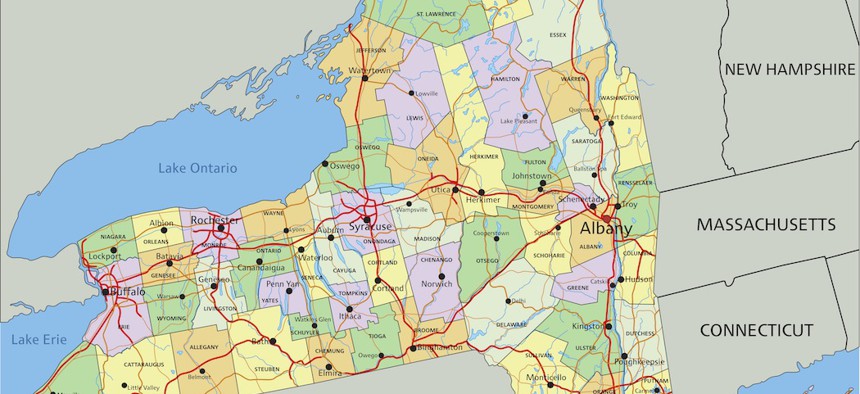
New York State
Mapping congressional redistricting
Here’s what New York’s new congressional boundaries could look like.
New York’s Democratic elected officials are pushing a new amendment to the state constitution to condense the redistricting schedule. Bardcoz Peter/Shutterstock

New York Democrats have the power to draw a congressional map of their choosing in the upcoming round of redistricting. While the latest census data isn’t yet available, City & State used an open-source mapping tool called DistrictBuilder to draw our own hypothetical map based on the 2020 presidential election and the 2010 census. The areas in color highlight just how promising the future political landscape might be for the Democrats compared to the current lines drawn in black.
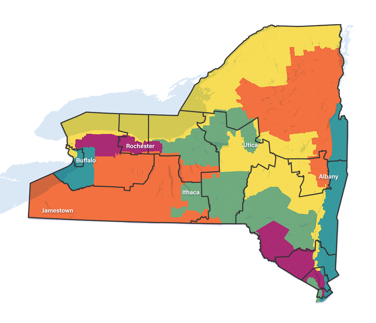
The yellow district along the Canadian border is an extreme example of how Democrats could meet the requirement that all districts be contiguous and have equal populations. The district would run from the Buffalo suburbs through Democratic areas of Monroe County, which surrounds Rochester, and terminate in the blue areas of the North Country. Splitting Fort Drum off from the Adirondacks could also deprive incumbent Rep. Elise Stefanik of one of her favorite places to visit.
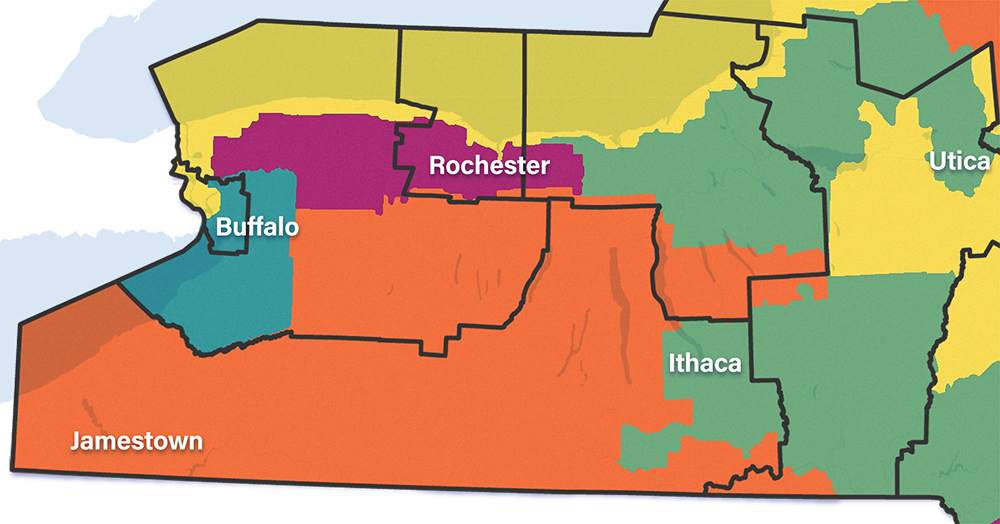
Splitting major urban centers allows Democrats to use their party base to outnumber voters in more competitive suburban and rural areas. While that could pass muster in the courts, effective gerrymandering risks backlash from voters and incumbents who like their districts as they already are.
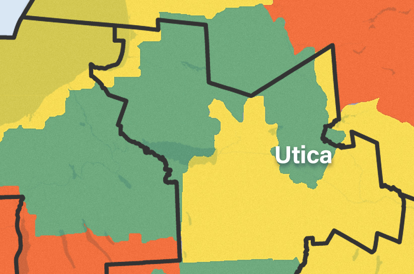
Central New York is one of the most important swing areas in the state. Democrats could split the area into different districts by using block-level data that maximizes partisan advantage. The hypothetical map here uses 2010 census data and the 2020 presidential election results to predict how this area of the state could become solid blue moving forward.
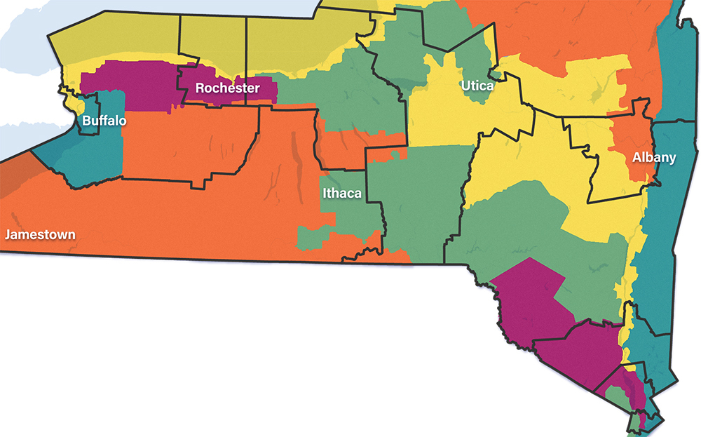
Cracking Repbulican dominance of the North Country comes down to breaking up the current district into pieces. Voters in left-leaning urban areas like Saratoga Springs and Albany, for example, mean the GOP would have to win big margins in rural areas in order to compete.
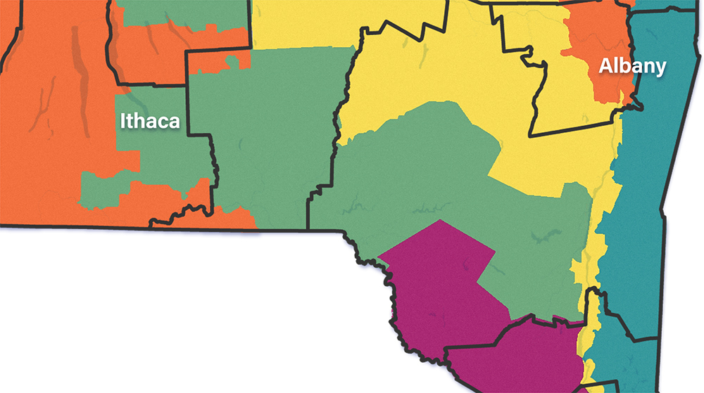
Many liberal strongholds are stuck inside solid red districts. Detaching Ithaca from a district representing the Southern Tier and placing it with areas to the east, would allow Democrats to make more use of voters who would otherwise be wasted in a red district.
Democrats can use redistricting to unseat some of the eight current Republicans in the state’s congressional delegation, but they likely cannot eliminate all of them. A GOP superdistrict stretching across suburban and rural areas of Western New York would be solid red for the next 10 years, but for every reliable Republican, there is one less vote that Democrats have to worry about in more competitive districts.
One of the oldest redistricting tricks in the books is using long and skinny strips. A little bit of the western bank of the Hudson River could help defend Democratic turf upstate. The eastern side – and maybe a little bit of the Bronx – could even have a role to play in making sure Republicans get no chance of ever winning the North Country again. The only problem might be explaining to voters how districts like that represent cohesive communities.
NEXT STORY: The other shoe drops for Cuomo