New York City
The tide will be high, can New York hold on?
Would such dramatic sea level rise catch New York off-guard? New York City and Long Island have made some efforts to prepare their coastlines, but at the same time new development is going into neighborhoods that could be underwater by the century’s end.
nyc waterfront pisaphotography/shutterstock

In March, New York City Mayor Bill de Blasio rolled out an enormous and headline-grabbing proposal to prepare lower Manhattan for the effects of climate change. In a press conference and an article for New York magazine, the mayor described a plan to extend the island into the East River by two city blocks.
The Lower Manhattan Coastal Resiliency Project is ambitious, expensive and, as the magazine pointed out in a subsequent article, “pretty vague.” It prompted a slew of questions and prominent among them was how the estimated $10 billion price tag would be covered. Others wondered about the fairness of fortifying lower Manhattan while leaving other, less wealthy neighborhoods to fend for themselves. “If we’re going to implore Washington for billions of dollars, we should come up with a comprehensive plan that protects the entire city,” New York City Councilman Costa Constantinides and Nilda Mesa, the former director of the Mayor’s Office of Sustainability, wrote in an op-ed.
De Blasio’s proposed landfill project would be used for parkland to soak up storm surges, rather than for housing or offices. But New Yorkers are increasingly drawn to living or working on the waterfront and developers are eager to give them what they want. Last year, the real estate data website Localize.city found that 1 in 8 new apartments under construction or planned in the city were in high-risk flood zones, the majority in the hip Brooklyn and Queens neighborhoods of Williamsburg, Greenpoint and Long Island City, strung along the East River and Newtown Creek.
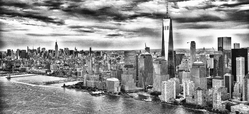
The massive Hudson Yards project rising on Manhattan’s West Side is in a location that could be underwater by the end of the century if sea levels rise 8 feet. The Rockaways and the banks of the Gowanus Canal are getting new housing; even Brooklyn’s Coney Island and Sheepshead Bay and the South Bronx’s Mott Haven are getting new luxury high-rises near the waterfront. New York City’s first outlet mall is coming to Staten Island’s North Shore.
Many of these new developments, and others such as office and retail projects in Brooklyn’s Sunset Park, are taking over industrial blocks that have sat vacant or underused for years. Amazon planned its now-scuttled headquarters in Queens’ low-lying Anable Basin. While the city’s recently updated building codes and forward-thinking design probably would’ve protected Amazon’s headquarters, neighborhood residents wondered if the project would’ve simply redirected rising waters elsewhere, into less prepared, less affluent areas.
“The mayor’s recent proposal for Lower Manhattan – you can argue the merits of it, you can argue the funding streams of it – but it does take seriously the long-term threat to Lower Manhattan.” – Robert Freudenberg, Regional Plan Association vice president of energy and environmental programs
In New York City and the region, preparing for a changing climate has been uneven. Some communities have plans in place for sea levels that may be 2 1/2 feet higher by mid-century; others are merely bracing for the next major storm. Across New York, 269,165 homes are in the 100-year flood plain – the fourth most of any state in the nation – according to a 2017 analysis by the NYU Furman Center. That means those homes have a 1 percent chance of flooding in a given year, a chance that is increasing with climate change.
“There are a lot of different neighborhoods, and they’re taking different approaches,” Robert Freudenberg, the vice president of energy and environment for the Regional Plan Association, told City & State. “The mayor’s recent proposal for lower Manhattan – you can argue the merits of it, you can argue the funding streams of it – but it does take seriously the long-term threat to lower Manhattan. In suburban communities, it’s been a little harder. I think that the focus in suburbs, on Long Island in particular, has been still recovery from (Superstorm) Sandy or response to Sandy: How do we deal with the storm that comes along periodically?”
Whether or not New York and its environs are ready, the waters are coming. That fact was underlined the day after the mayor’s big proposal when, to considerably less fanfare, the New York City Panel on Climate Change – a body made up of top climate scientists, urban planners and risk management experts – released its third report. Unlike previous reports by the panel, this one spent a good deal of time examining a scenario that scientists have been warning of in recent years: the possibility that humans won’t heed urgent warnings in time, or that climate change will reach the worst extreme of its possible outcomes, and large parts of Antarctica will just melt. If that happened, bringing upward of 9 feet of sea level rise in the second half of this century, the result would be catastrophic for New York City and the area around it.
“As New Yorkers, we cannot and will not abandon our waterfront. It’s one of our greatest assets. We must protect it, not retreat from it.” – then-New York City Mayor Michael Bloomberg, in 2013
To prepare for the sea level rise and floods to come, then-Mayor Michael Bloomberg’s 2007 PlaNYC laid out a slate of proposals based on sea level rise projections of 2 feet by 2050 and projected sea level rise out to more than 2 1/2 feet in the 2080s. In 2013, months before he left office, Bloomberg released a comprehensive, $19.5 billion plan for “A Stronger, More Resilient New York.” It included proposals strengthening building codes, requiring that critical building equipment be elevated above anticipated flood levels, updating zoning, rebuilding damaged housing stock and updating public housing. He also called for the construction of flood walls, storm surge barriers and dune systems to decrease the impacts of floods throughout the city. The plan came along with updated Federal Emergency Management Agency flood maps, which previously had relied on data from 1983, and updated projections of sea level rise from the New York City Panel on Climate Change, now showing 2 1/2 feet by 2050.
At a press conference, Bloomberg leaned into the looming battle: “As New Yorkers, we cannot and will not abandon our waterfront. It’s one of our greatest assets. We must protect it, not retreat from it.”
After Superstorm Sandy, regulatory changes to brace for more frequent floods have continued. New York City changed the zoning for neighborhoods that already see periodic flooding during full moon high tides and that were hit hard by Sandy, including Queens’ Broad Channel and Hamilton Beach. These new zoning codes will prevent these neighborhoods from growing denser. City building codes now also require higher elevation for new construction or substantial improvements to existing buildings in flood hazard areas. The latest revisions of the codes, in March, encourage builders to take into account that seas could rise 18 to 39 inches by the 2080s.
Projections suggest possible outcomes worse than that: Seas could rise by more than 58 inches by 2080, and more than 75 inches by 2100, according to the New York City Panel on Climate Change. Would such dramatic sea level rise catch New York off guard? “The science says that one, whatever happens, these high-end outcomes are very sensitive to emissions, and two, they’re also quite sensitive to us being unlucky with physics,” said Robert Kopp, a climate scientist at Rutgers University and co-author of the New York City Panel on Climate Change’s recent report. “And we just don’t know enough to say whether we’re lucky or unlucky. So the approach you want to take if possible is a flexible approach.”
This kind of catastrophe is not a given. The panel’s report called it “a new, physically plausible upper-end, low probability” scenario, “one with significantly less than 10% likelihood of occurrence by 2100.”
However, as the years pass and global greenhouse gas emissions keep rising, the likelihood that high-end scenarios for sea level rise come to fruition keep growing, and the question of whether New York City and state are ready for the possibility becomes more urgent.

Around the time when the 2015 Paris climate agreement was being finalized, it looked as if the world might rise to meet the challenge of climate change and keep warming below, or at least near, the widely held 2 degrees Celsius goal. Since then, things have gone a bit off the rails. President Donald Trump announced his intention to withdraw the United States from the Paris agreement and his administration is unwinding Obama-era carbon emission regulations. Some countries, particularly in Asia, are increasing their number of coal-fired power plants. Carbon dioxide levels reached an all-time high in 2018.
If the world continues on this path, the Atlantic coast may be facing several more feet of sea level rise by the end of the century than previously projected. With 8 feet of sea level rise, parts of southeastern Queens and southern Brooklyn, including nearly all of the Rockaways, Howard Beach, Coney Island and Canarsie, would be underwater. The East and Hudson rivers would take several bites out of Manhattan, including much of the East Village. Red Hook in Brooklyn and Long Island City in Queens would also be largely below sea level. The southern shores of Staten Island and Long Island would be reshaped; on Long Island, the barrier islands where New Yorkers go to soak up the sun – Jones Beach, Fire Island, the dunes off the coast of the Hamptons – would be virtually eliminated. Few ocean-facing communities on the island wouldn’t see neighborhoods disappear.
More frequent and severe storm surges would drive waters still higher. By 2050, a 100-year flood could reach more than 13 feet above sea level. By 2100, the New York City Panel on Climate Change’s high-end estimate for a 100-year flood is 17.6 feet, increasing to 20.7 feet if Antarctica’s ice melts rapidly. The chance that homeowners with a 30-year mortgage will see a 100-year flood during the term of their mortgage is one-third. (Superstorm Sandy was somewhere between a 100-year flood and a 500-year flood, according to the New York City Department of City Planning.)
By 2100, today’s 100-year flood – something slightly less dramatic than what Superstorm Sandy brought – could come every 10 years. That’s bad news for new projects in places that were flooded during Sandy, such as Coney Island, the Rockaways and Long Island’s barrier islands.
New York City, and many Long Island communities, are not ignoring these risks. The city Department of City Planning is preparing to make permanent emergency zoning rules that were put in place on a temporary basis after Superstorm Sandy, and expand the area they cover. These rules were meant to remove any regulatory hurdles that might prevent homeowners from making improvements, such as elevating their living space and key infrastructure, to prepare their homes for the next flood. In addition to making these codes permanent, the planning department told City & State it intends to expand the area these codes cover to neighborhoods with a 0.2% chance of a flood – a swath that includes nearly 800,000 New Yorkers.
The building codes and zoning changes would require new and renovated buildings to be prepared to withstand storms. They’re not mandatory, however, for existing structures, potentially leaving many older buildings in New York City’s flood plains vulnerable.
Meanwhile, even buildings that are prepared for rising waters could find themselves in neighborhoods that are not. “Those buildings themselves may be OK because they are actually constructed in such a way that they can flood,” Klaus Jacob, a research scientist at Columbia University, told NPR. “But people may not be able to get in and out of those buildings because the streets are flooded.”
Many New Yorkers could find themselves spending time in Venice-like neighborhoods, living and working in communities surrounded by water. “In areas where people are going to see sunny day flooding in their backyards in 2050 – or already, as is the case in some neighborhoods – we don’t have a clear plan for whether we need to provide more resources for relocation or rebuilding in place than we’ve already got,” said Kate Boicourt, director of resilience for the Waterfront Alliance, a nonprofit group that advocates for policy related to New York City’s waterfronts.
Some of New York’s new jobs are also in low-lying waterfront areas, such as tech and manufacturing campuses in Brooklyn’s Dumbo and Sunset Park. “What we have known for quite a while continues to get worse,” said Edgar Westerhof, the national director for flood risk and resiliency for Arcadis North America, a design, engineering and consulting company that has worked on many of New York City’s coastal resiliency projects. “That is indeed reason for our city leadership to rethink what we are doing, because there’s still quite a bit of development happening in low-lying places where you may wonder if that’s a good place, in a flood plain.”
While particularly acute in the city, where demand for living space is high, the issue also extends to Long Island where residents, who struggled to recover from Superstorm Sandy, have raised concerns about the wisdom of building new homes in flood-prone areas. Those projects include developments on Long Island’s South Shore meant as affordable housing, such as one such controversial project in Babylon that mixes NIMBYism with concerns about future floods. “It’s 2 to 3 feet every time it rains,” one resident told Newsday of a Sandy-damaged lot slotted for an affordable housing development. “You cannot put a house there.”
In some of the most vulnerable areas affected by Superstorm Sandy, homeowners were given incentives not to return. In Oakwood Beach, a community on Staten Island’s eastern shore, where the majority of residents took state-offered buyouts, the community today is returning to nature, and will be a buffer zone when the next storm slams into the island. Hundreds of residents in Long Island’s Suffolk County also participated in the state buyout program, though Nassau County chose not to opt in, fearing the loss of property tax revenue from leaving such areas uninhabited.
These sorts of programs will have to become more common. New York City should begin to weigh “paradigm-shifting concepts such as strategic relocation programs on flood plains and densification on high ground,” according to the New York City Panel on Climate Change report. In order to prepare for the future that could be in store, the city’s population – and the state’s – would have to shift out of the ocean’s way.
While previous buyout programs have largely been reactive – following a storm, such as Superstorm Sandy – experts recommend that New York City and state need to begin considering buyouts before disaster strikes. “In general, I think it is better to do this sort of planning in a flexible approach, thought out over the course of several decades, as opposed to what the alternative is – which is basically post-disaster relocation, and which is when most relocations and buyouts tend to happen,” Kopp said.
That is a tricky and loaded conversation that few policymakers have been eager to have. “When we start talking about relocation, it sort of takes away the agency of decision-making from an individual that might have ended up (in a flood-prone area) because they don’t have a lot of options,” Boicourt said. “I think the bigger challenge is that if we don’t have that conversation now, which is going to be a super hairy one, the people that are going to lose out the most are those that don’t have resources.”
The debate between planned retreat and fortification is a lively one, with some experts urging New York City to entirely prevent development in neighborhoods that look likely to be submerged in the future. The National Flood Insurance Program has a designation called “repetitive loss” for buildings that are damaged multiple times in a 10-year period. Some experts, including those behind the Regional Plan Association’s Fourth Regional Plan, suggest those could be a place to consider an end to development. “Any areas that are repetitive loss, that’s probably where you should start with a moratorium; maybe after the storm, don’t build it back,” said Freudenberg, of the Regional Plan Association. “Start adding these designations into master plans and things like that. This is where policy needs to change as well, both at the state and local levels. If we know where the risk is and we know where the damage occurred, it’s time now to put an end to developing in these places.”
Yet such a moratorium would constrain an already tight market. In New York City and the surrounding area, rents are rising along with the seas. New York City’s astronomical costs for housing and office space create plenty of demand for waterfront properties that take advantage of the few remaining convenient locations that aren’t already fully built out.

In total, the cost of climate change preparation will dwarf the $10 billion for de Blasio’s Lower Manhattan Coastal Resiliency Project – assuming the money can be found. In addition to buying out homeowners, there’s also the cost of the new infrastructure to fortify communities that stay put. These can take the form of parks to absorb storm surges, such as a new one recently opened off Hunter’s Point South in Queens; resiliency projects to shore up streambanks and improve drainage funded by the U.S. Department of Housing and Urban Development along the banks of the Mill River on Long Island; or massive infrastructure projects of the type we expect to find protecting New Orleans and the Gulf Coast – sea walls, levees and floodgates, often maintained by the Army Corps of Engineers.
Some initial attempts provide cautionary tales about the need for community input. For example, the $1.45 billion project that includes a massive sea wall along Manhattan’s Lower East Side – residents have objected to recent changes in the plan, particularly a proposal that would bury East River Park beneath up to 10 feet of landfill, on top of which a new park would be built. Residents felt the city abandoned a plan on which they had given substantial input for one on which they had little. “The way this planning is being done is disempowering,” Vaylateena Jones, a 50-year Lower East Side resident, was quoted saying during a January community board meeting by the Times. “City officials collaborated with us over four years and came up with a detailed design – only to now return with this entirely new design. Do our voices even matter?”
A larger project to protect New York City’s harbor – a 5-mile storm surge protection wall running from Breezy Point on the southern tip of the Rockaways to Sandy Hook, New Jersey – is the most sweeping of a slate of proposals by the Army Corps of Engineers which have proven controversial, drawing denunciations from environmental groups, which say these extreme measures would destroy aquatic life.
“If we take the Lower Manhattan Coastal Resiliency Project, or the East Side Coastal Resiliency Project, or Amazon, there’s a common thread there which is discontinuous public engagement or a lack of public engagement,” Boicourt said. “I think that is very concerning for setting the stage for decisions that we are making that are going to last generations.”
This, along with the uneven approach to planning across the city and region and the need to mobilize massive amounts of funding, have all led to calls for a citywide or regional government entity to manage climate adaptation, overseeing the work of various government agencies and collecting input from citizens. Nilda Mesa, the former de Blasio official who now heads Columbia University’s Center for Sustainable Urban Development, described a “comprehensive approach and strategy managed by one entity that is answerable to city residents, that conducts its processes in a transparent way and that relies on the best science and engineering.”
“We’re all in this together,” she added. “We need to be talking to our neighbors as well, New Jersey and Long Island.”
In February, New York City Councilman Costa Constantinides introduced legislation that would create such an entity.
Preparing the region for the worst-case scenario New York might face between 2050 and 2100 presents a political challenge: Are elected officials, dealing with urgent, immediate needs and facing reelection every four years, going to spend money today to prepare for a future they may not even live to see?
As emissions continue to rise globally – despite the city’s successful efforts to cut its own – the reality that the coastlines in the region will change, as will the way people live along them, is becoming increasingly unavoidable.
NEXT STORY: How to make the ‘Green New Deal’ good for cities