New York State
Five big takeaways from the new Assembly draft map
While it’s been a long, bumpy road, the Independent Redistricting Commission’s new map is the beginning of the end to this year’s redistricting mess.
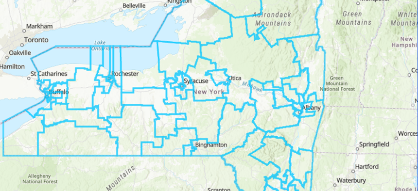
The state Independent Redistricting Commission is back to work and just released the first draft of new Assembly districts. Screenshot/New York state Independent Redistricting Commission

The state Independent Redistricting Commission voted to move forward with a new draft map of the Assembly districts during a public meeting on Thursday. The new maps show significant changes to the map used in this year’s election.
After Steuben County Judge Patrick McAllister invalidated the proposed maps for New York’s congressional, state Senate and Assembly districts earlier this year, a special master was appointed to draft new congressional and state Senate maps. While the Assembly maps stayed in place initially, another lawsuit by political activists got them tossed out on appeal. The court ultimately ruled the proposed Assembly maps would be used for this year’s election but would need to be revised for the 2024 elections. Then in September, a Manhattan Supreme Court judge ruled that the Independent Redistricting Commission would be responsible for submitting new maps by April 2023.
Since then, all eyes have been on the commission as they approached a court-imposed Dec. 2 deadline to present a new draft map. Two weeks before the deadline, the commission’s chair, David Imamura, resigned to run for the Westchester County Legislature, leaving the panel leaderless. However, that did not hinder the commission from meeting its deadline.
During its presentation of the new maps, Ken Jenkins, the Westchester deputy county executive and newly appointed chair of the Independent Redistricting Commission, explained that the commission met with its Republicans and Democratic members in preparing the draft of the new Assembly districts. Vice Chair Charles Nesbitt underscored that the commission had previously produced two separate maps – one from Republican-appointed commissioners and one from the Democrats – but the new draft was the first time the commission had been able to produce a single map that was accepted by both political parties. “This is a significant moment, maybe even a historic one,” Nesbitt said. “That in itself signals an era of cooperation and productive work by this commission that is important for all in the state of New York.”
In the commission’s previous plans from this year, there was Plan A, which was created by the Democratic commissioners, and Plan B crafted by the Republican commissioners. Of the 150 districts, 105 districts were identical to the prior GOP plan in this draft map, according to Steven Romalewski, who is the director of the CUNY Mapping Service at the Center for Urban Research.
Jeffrey Wice, a professor at New York Law School, agreed the commission’s ability to produce a single map was a significant milestone. But Wice also pointed out that the journey to finalizing the Assembly maps was far from over. “Being able to agree on one map in itself is a major accomplishment, but we’ve got plenty of time ahead of us to see what public comment will look like and how today’s plan might change before it goes to the Legislature,” Wice said.
The commission will hold public hearings from Jan. 9 to March 1 across the state on the newly drawn map. The deadline for the commission to present a final map to the state Legislature is April 28, 2023.
The latest draft showed shake-ups across the state, from southern Brooklyn to the lower Hudson Valley and upstate. Here are the biggest takeaways from the latest draft map of the new Assembly districts:
Changes in southern Brooklyn
The new map does away with the Bay Ridge to Coney Island seat in Assembly District 46, currently held by Assembly Member Mathylde Frontus and was recently won by Assembly Member-elect Alec Brook-Krasny. The draft of the Assembly District 46 now includes parts of Bensonhurst in Brooklyn, while parts of Coney Island have been moved to District 45.
Western Queens and Upper East Side joining forces
As it stands, Assembly districts don’t span the East River to join Queens and Manhattan. But the new proposed District 36 would bundle into one seat the Upper East Side of Manhattan, Roosevelt Island and the Long Island City and Astoria waterfronts in Queens. It would take from portions of retiring Assembly Members Dan Quart and Cathy Nolan’s districts.
Lower Hudson Valley gerrymander tamed
The infamous gerrymandered Assembly District 101, which ran like a snake across seven counties from the Lower Hudson Valley up to Utica, has been eliminated in the latest draft. “Districts need to be more compact. They can’t favor or disfavor political parties,” Wice said of the district. Additionally, Assembly District 100, which is largely in Sullivan County, has been expanded to include more Republican areas, potentially putting Democratic Assembly Member Aileen Gunther in jeopardy. The district flipped from being a Biden +5% district in the 2020 election to a Trump +10% district.
Shake-up in Syracuse
The commission also cleaned up the three gerrymandered districts that make up the bulk of Syracuse in Onondaga County. While Democrats still have large voting advantages in Assembly Districts 127, 128 and 129, the commission did away with the big swirl of District 129 that almost enveloped the city.
Staten Island and lower Manhattan parting ways
The current Assembly District 61, represented by Assembly Member Charles Fall, combined Staten Island and lower Manhattan. In the new map draft, the two boroughs are now separated. Northern Staten Island would continue to be District 61, while the southern tip of Manhattan would be combined with part of the Lower East Side to form District 65.
Correction: An earlier version of this story incorrectly identified the courts that have ruled on the redistricting process.
NEXT STORY: Peter Abbate is fundraising – but doesn’t think he’ll run again